Ruoergai CountyZoige County
Zoige County is located in the northeastern edge of the Qinghai-Tibet Plateau. It is the northern gate of Sichuan Province to the northwestern provinces. Its geographic coordinates are 102 08 to 103 39 East and 32 56 to 34 19 north. Its neighbors are Maqu County, Luqu County, Zhuoni County, Diebu County and Gansu Province, respectively. Aba County, Hongyuan County, Songpan County and Jiuzhaigou County are bordered by Aba Prefecture. The Yellow River and the Yangtze River divide it into two parts. The largest distance between the East and the west is about 150 kilometers. It is 475.3 kilometers from Lanzhou, 322.4 kilometers from Malkang, 469.2 kilometers from Chengdu to the South and 3406 meters above sea level from the county seat.
Zoige County has an area of 10436.58 square kilometers. At the end of 2010, Zoige County has a total population of 75,791. Dazhasi Town is the county's political, economic and cultural center.
In 2013, Zoige County achieved a GDP of 1.35 billion yuan, an increase of 14% over 2012, and an industrial output value of 236 million yuan, an increase of 14.1% over the same period of the year. The total industrial added value was 120 million yuan, of which 62.5 million yuan was added to the value of industries above the scale. The total retail sales of consumer goods is expected to reach 360 million yuan.
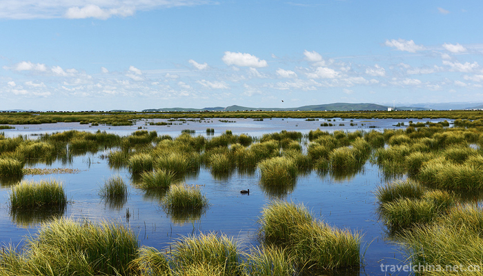
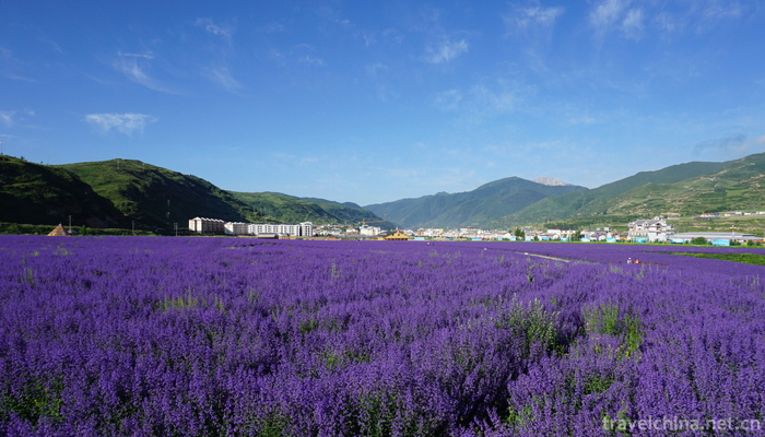
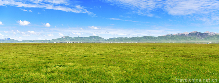
In 2005, the Geer prairie was named "the most beautiful wetland in China" by National Geographic magazine.
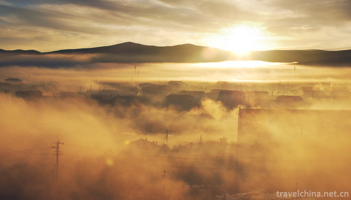
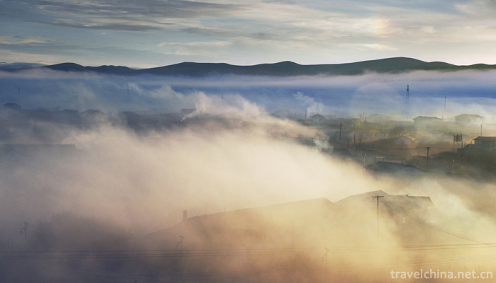
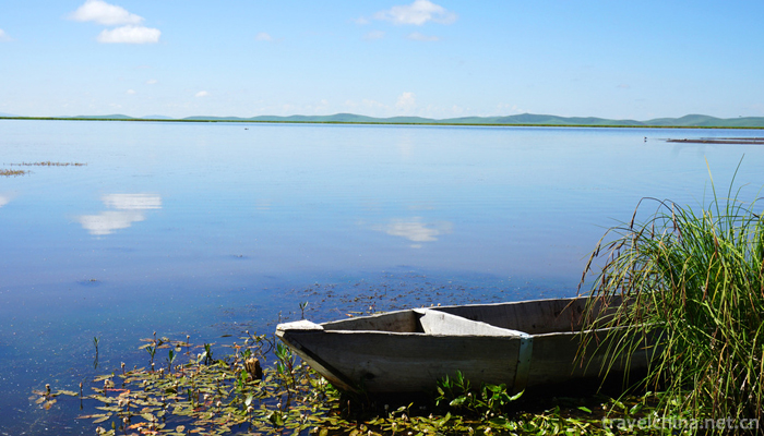
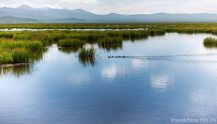
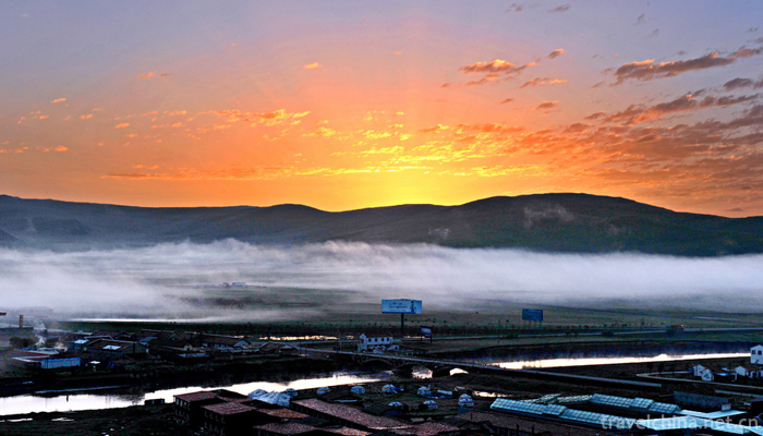
Zoige County enjoys the reputation of "the most beautiful alpine wetland grassland in China" and "the hometown of black-necked cranes in China", known as "oasis of Northwest Sichuan plateau" and "cloud paradise".
In September 25, 2018, the Ministry of Commerce received the honorary title of "e-commerce in 2018 into the rural comprehensive demonstration county".
In the Western Han Dynasty, the Ruoergai area belonged to the white horse range.
In the Northern Zhou Dynasty, in the eastern part of the county, the area was located in the county of Junxiang county.
In the Sui Dynasty, the pass county was Wenshan County, and the Tang Dynasty was controlled by the state of the Song Dynasty. During the strong period of Tubo, it was ruled by Tubo.
The Yuan Dynasty set up pan state in Jixiang Township today.
In the Ming Dynasty, the first word of the two states was named Songpan Wei.
In the Qing Dynasty, the Ministry of leather and toast was established in this county. In the Republic of China, it belonged to Songpan county.
In August 1950, the Maoxian prefectural Party committee and Songpan County sent a working group to work in the area. In 1951, the Songpan County Government sent a working group to Langmu Temple to hold a meeting of the twelve tribes of Ruoergai Tuguan to carry out work.
In 1953, the People's Liberation Army marched into the grassland to eliminate the remnants of the Kuomintang army, Ma Liang. In June, the 12 tribes of Zoige and the seven houses of Zoige were jointly built into the Zoige Baozang Administrative Committee. In 1956, Ruoergai county was built in 7, belonging to Aba Tibetan and Qiang Autonomous Prefecture.
The name of the county comes from the name of a great housekeeper from Tibet. The servant is called Geng, who translated and wrote Ruoergai. One name is Ruoergai tribe.
topographic features
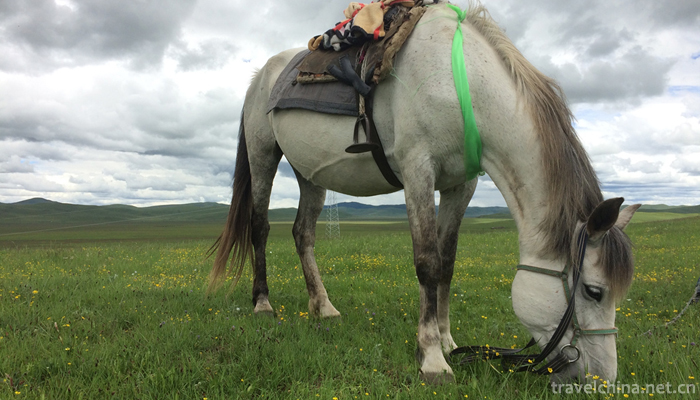
The terrain of Zoige County is complex. The watershed between the Yellow River and the Yangtze River Valley divides the county into two distinct geographical units and natural economic zones. The central and southern parts of the country are typical hilly Highlands, accounting for 69% of the total area of the county, and the terrain is tilted from south to north. The average altitude is 3500 meters. The northern and southeastern mountainous system is the western part of Qinling Mountains and the northern end of Minshan Mountains.
climate
Ruoergai county belongs to the humid monsoon climate of the plateau cold temperate zone, and has no summer all the year round. The annual average temperature is 1.1 degrees, and the annual precipitation is 648.5 millimeters. There is no absolute frost free period. Rainfall mostly concentrated in late May to mid July, with an annual rainfall of 656.8 millimeters. The annual relative humidity is 69%. The land begins to freeze in late September every year, and thaw is completely thawed in mid May, and the deepest part of frozen soil is 72 centimeters.
hydrology
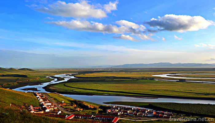
The main rivers in Zoige County are the Bailong River, the Baozuo River and the Brazilian River, and Gaqu, Moqu and Requ, which flow from south to North into the Yellow River.


-
1.Huanshui Bay Hot Spring Resort
Huanshui Bay Hot Spring Tourist Area of Anyang City is located at the exit of Anlin Expressway in Anyang Hi-tech Development Zone, Henan Province, close to National Highway 107 and the west side of Be
Time 2019-01-17 -
2.Jinshuitai Hot Spring Scenic Area
Jinshuitai Hot Spring is a hot spring resort built according to the national AAAA scenic standard. It is located in Shuitai Town, Xinxing County, Guangdong Province
Time 2019-01-27 -
3.Tanxi Mountain Scenic Area
Tanxi Mountain Tourist Area: National AAAA Tourist Area, National Forest Park, National Geopark, National Water Conservancy Scenic Area and Key Scenic Spots in Shandong Province.
Time 2019-02-13 -
4.Tibetan Gugu Encouragement
Tibetan God inspiration has a long history. As for its origin, there is a legend that one or two hundred years ago, a "Gawa Hubo" (i.e. a local official) in Ningba village danced in the mans
Time 2019-04-05 -
5.Couplet Custom
Couplet is a couplet inscribed on the pillar of the couplet, also refers to the couplet, is a unique form of literature and art in China. The custom of couplets originated from the dual phenomenon of
Time 2019-07-14 -
6.Girl on Bridge Hai Lun Tik Tok Songs 2020 Hot Songs
Girl on Bridge is a song composed and sung by Helen and released on November 9, 2019
Time 2020-05-21 -
7.Ertan scenic spot
Ertan National Forest Park is located in Chengdu Emeishan Xichang Kunming tourist hotline. The majestic power station, the misty blue lake, the surrounding green mountains, the wild virgin forest
Time 2020-10-16 -
8.Luodai Ancient Town
Luodai Ancient Town is located in Longquanyi District, Chengdu City, Sichuan Province, with a total area of more than 20000 square meters. Luodai Ancient Town is a national historical and cultural town and one of the five "Dongshan five fields" in Chengdu.
Time 2020-11-05 -
9.Contact information of Chengdu Giant Panda Base
Contact information of Chengdu Giant Panda Base
Time 2020-12-13 -
10.Geographical environment of Deyang
Deyang City is located in the northeast edge of Chengdu Plain, with geographical coordinates of 30 ° 31 ′ - 31 ° 42 ′ N and 103 ° 45 ′ - 105 ° 15 ′ E. Deyang borders Fucheng District of Mianyang City in the northeast, Santai County of Mianyang City in the East
Time 2020-12-14 -
11.Hydrological survey of Mianyang
Affected by the landform, Mianyang has abundant precipitation, large runoff, vertical and horizontal rivers and developed water system. There are more than 3000 rivers and gullies in the city. All rivers and gullies flow into Fujiang, Bailongjiang and Xihe
Time 2020-12-14 -
12.Neijiang cultural undertakings
By the end of 2019, there are 121 performing arts venues in Neijiang City, including 6 cultural venues. There are 5 museums, 5 cultural relics protection and management institutions, 7 national key cultural relics protection units, 42 provincial cultural relics
Time 2020-12-16