Wucai Beach
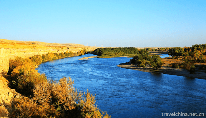
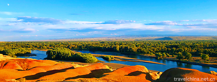
The Wucai Beach is located in Buerjin County, Altay area, north end of Xinjiang. It is located on the first and second terraces on the North Bank of Ertiz River, the only one injected into the Arctic Ocean in China. It is 480 meters above sea level and 24 kilometers away from Buerjin County Town. It is also the only way to Kanas Lake Scenic Area. April 13, 2018, was included in "Magic Northwest 100 Scenes".
brief introduction
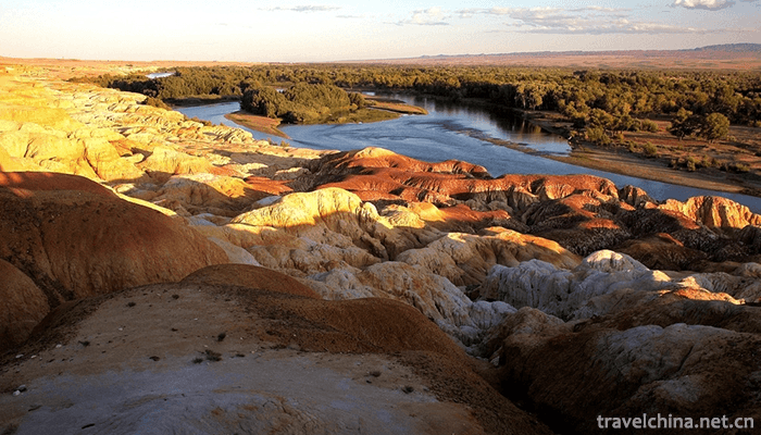
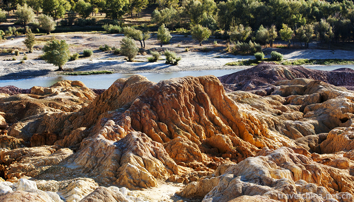
The two sides of the Five-color Beach and the river are different from north to south. It is a national 4A-level scenic spot. The Wucai Beach, located in Yegezitobe Township, about 24 kilometers northwest of Buljin County, Xinjiang Uygur Autonomous Region, crosses the Ertiz River into the Arctic Ocean. Five-color beach landform is special, long-term dry zone, which belongs to the typical color hills (or hills).
April 13, 2018, was included in "Magic Northwest 100 Scenes".
Geographical profile
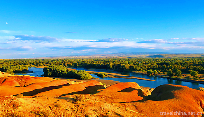
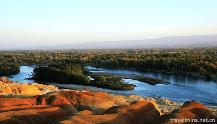
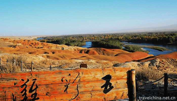
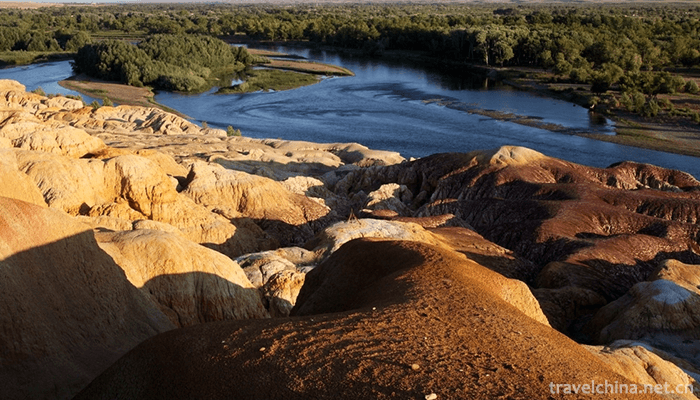
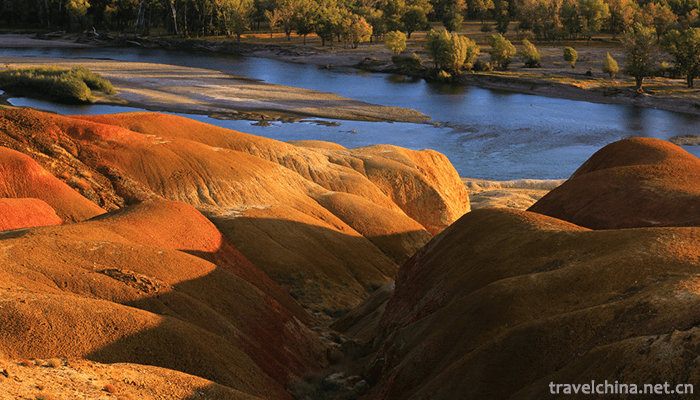
The Wucai Beach is located about 24 kilometers north of Buljin County Town. It is the only way to Habahe County and Kanas. It is adjacent to the Ertiz River, which ripples in the blue waves. It reflects the lush and verdant River Valley scenery on the opposite bank. It can be said that "one river separates two banks, since it has two days". The weathering resistance of riverbank strata varies, and the outline varies. The different minerals in the rocks give rise to various splendors, so they are named "Five-color Beach".
There are large-scale wind power generation websites in front of the Wucaitan scenic spot. Mountains on the north bank are undulating and changeable in color. They are formed by violent River erosion, cutting and gale erosion. Because the weathering resistance of riverbank rock layers varies in strength and form uneven outlines, the rock color here is changeable, and under sunset, the rock color is mainly red, green, purple, yellow, white, black and transitional colors, colorful. Whenever the wind blows, there will be strange cries of different lengths and heights in the ditches and under the rocks.
Geological origin
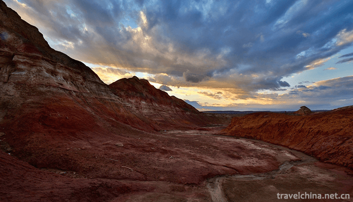
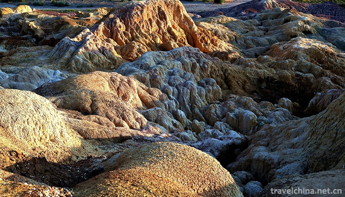
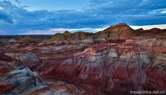
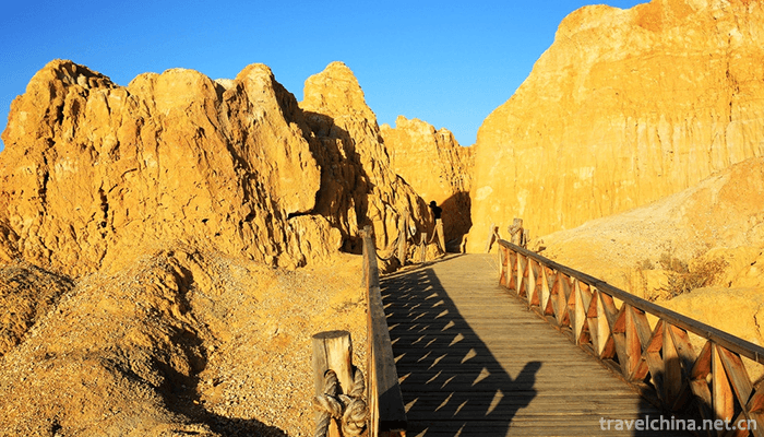
The multi-color riverbank is formed by flow erosion cutting and wind erosion. On terrace slopes, gullies grow vertically and horizontally, valleys and small soil beams are developed, the width is 5-10 meters, the height of soil beams is generally 5-15 meters, the maximum height is about 25 meters, the height is scattered, and the distribution area is about 3 square kilometers. Located in the arid and windy zone, the weathering resistance of riverbank rocks varies from layer to layer, resulting in uneven outlines. The rocks are composed of red, earth red, light yellow and light green sandstone, mudstone and sandy conglomerate. The rocks are of different colours and colorful shapes, such as coloured castles, monsters and peak clusters. They are typical coloured hills. When the wind blows, it makes strange sounds, which adds mysterious color. Its development and construction undoubtedly add to the scenery of Kanas scenic spot, with considerable passenger flow and economic benefits. The colorful riverbanks will attract tourists both at home and abroad to come here for sightseeing with their typical and unique landforms.
There are large and small stone peaks, stone walls and stone pillars in the scenic area of Wucaitan Beach. The peaks are like forests, dense and intertwined, and their shapes are gorgeous.
Ticket information
In 2008, the ticket price of Wucaitan scenic spot is 50 yuan per person, and will be adjusted according to the specific conditions of scenic spot construction, management, service quality and environmental improvement. For minors (children under 1.3 meters in height), elderly people over 65 years old and disabled people, tickets are exempted; for tourism teams, preferential fares are implemented. At the same time, the Wucaitan Scenic Spot and Tourism Administration emphasized that the clear-code price will be strictly enforced in the scenic spot to further improve the environmental conditions and improve the service level and quality.
In addition, considering the closed management of Wucaitan scenic spot, the implementation of one-time ticket purchase is effective within the same day. The above standards have been in effect since April 1, 2006.
Every year, from October 15 to April 15, the scenic area is closed due to weather changes, but there are duty personnel on the west side of the gate. During this period, you can go to the west side of the gate for sightseeing. There are monitoring facilities in the scenic area. Violators should pay 200-500 yuan compensation or hand over to the public security organs for treatment.
Traffic information
They can carpool to and from Burqin County accommodation and other places, with about 20-30 yuan per person. Drivers can wait outside the scenic area until sunset to take tourists back.

-
1.Rabbit head
Rabbit head is a traditional snack in Sichuan Chengdu, Shanxi Datong and Zhejiang Quzhou.
Time 2018-10-13 -
2.Zhenjiang Sanshan Scenic Area
Zhenjiang Sanshan Scenic Area is located in the southwest of Jiangsu Province and on the South Bank of the lower reaches of the Yangtze River
Time 2018-12-06 -
3.mount fanjing
Fanjingshan: National AAAAA-level tourist attractions, National Nature reserves, China's top ten summer resorts, China's famous Maitreya Bodhisattva Dao
Time 2018-12-12 -
4.Nanshan Bamboo Sea Scenic Area
Tianmu Hunan Shanzhuhai Scenic Area is located in Liyang, Jiangsu Province, which is the junction of Jiangsu and Anhui Provinces. It is a national 5A scenic spot.
Time 2018-12-31 -
5.Huangze Temple
Huangze Temple is the only sacrificial temple for Empress Wu Zetian in China. It is located on the West Jialing River in Guangyuan City, Sichuan Province. In 1961, it was announced
Time 2019-01-18 -
6.Xiaolangdi Dam
Xiaolangdi, the Yellow River Xiaolangdi, is located in the Yellow River Xiaolangdi Scenic Area at the junction of Luoyang City and Jiyuan City, Henan Province.
Time 2019-02-25 -
7.Traditional Toys Tancheng Wooden Rotary Toys
Tancheng Wooden Rotary Toy is an ancient traditional handicraft. Originated in Fanyuan Village, north of Gangshang Town, Tancheng County, Linyi City, Shandong Province, it is commonly known as "p
Time 2019-04-21 -
8.Kazakh felt embroidery and cloth embroidery
Kazakh folk traditional felt embroidery and cloth embroidery handicraft are mainly spread in Xinjiang Kazakh soft residential areas, such as the Sixth Division Red Banner Farm
Time 2019-05-02 -
9.Legend of Yellow Crane Tower
The legend of the Yellow Crane Tower has a long history, and has been accompanied by the repeated destruction and construction of the Yellow Crane Tower
Time 2019-05-04 -
10.Sun Bin quan
Sun Bin Quan is an ancient and rare traditional boxing in Shandong Province. Its connotation is broad and profound, which was created by Sun Bin, a military strategist in the Spring and Autumn Period
Time 2019-06-17 -
11.Wuqiang Wood Engraving New Year Picture
Wuqiang New Year's Painting is one of the traditional folk crafts in Wuqiang County, Hebei Province. It is named for its origin in Wuqiang County, Hebei Province. It is a unique style of Chinese folk
Time 2019-06-30 -
12.The position of Panzhihua
Panzhihua City is located at the junction of Sichuan and Yunnan in Southwest China, 26 ° 05 ′ - 27 ° 21 ′ N and 101 ° 08 ′ - 102 ° 15 ′ E. Jinsha River and Yalong River meet here. It borders Huili, Dechang and Yanyuan counties of Liangshan Yi Autonomous Prefecture
Time 2020-12-14