2018-10-13

- By ChinaWiki.net
- Chinese Edition
- 2020-12-14
Geographical environment of Mianyang
Location context
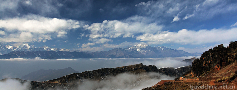
Mianyang City is located in the northwest of Sichuan Basin, in the middle and upper reaches of Fujiang River, bordering Qingchuan county and Jiange County of Guangyuan City in the East, Shehong city and Daying County in Suining City in the south, Luojiang District, Zhongjiang County and Mianzhu City in Deyang City in the west, and Jiuzhaigou County, Songpan county and Maoxian County in Aba Tibetan and Qiang Autonomous Prefecture and Wen County in Longnan City, Gansu Province in the northwest. It is between 103 ° 45 '- 105 ° 43' e and 30 ° 42 '- 33 ° 02' n. It is a narrow strip from northwest to Southeast, with the maximum width of 187 km from east to west and 256 km from north to south. The total area is 20248.4 square kilometers, accounting for 4.2% of the land area of Sichuan Province.
geological structure
In Mianyang City, the strata are well developed, the rock formation is complex, the lithology and lithofacies change greatly; the structural form is very complex due to multi-stage structural inheritance, interference and superposition; the late magmatism and regional metamorphism are weak; the sedimentary mineralization is strong, and the endogenous mineralization is weak. Taking Jiangyou fault as the boundary, it is divided into two first-order structural units. According to the plate theory, it is located in the meridional mosaic zone of the East and West plates in China, and it straddles the Ganzi Songpan geosyncline and Yangtze platform obliquely according to the trough platform theory. This regional geological pattern controls the spatial distribution and combination characteristics of natural conditions and resources such as lithofacies, strata, minerals, topography, landform, soil, climate, water system, biology, etc., and has a profound impact on human social and economic activities.
stratum
The strata of Mianyang city span Yangtze region and Bayan Har Qinling district. There are four zones, namely Sichuan Basin, Longmenshan, malkang and West Qinling, and six stratigraphic zones, namely Nanchong, Guangyuan, northern Longmenshan, middle Longmenshan, Jinchuan and Motianling.
According to the existing data, the middle and Upper Cambrian, Upper Cretaceous and Tertiary strata are generally missing, only a small number of Middle Ordovician strata are exposed, and the other strata are developed and exposed. The total thickness of the deposit is more than 33637m. The stratigraphic distribution law is that the Triassic strata and the lower strata are exposed in the Longmenshan fold belt in the Northwest Mountain Area; the Mesozoic Jurassic and Cretaceous red beds are widely distributed in the knobs structure belt in the hilly area of the southeast of the city.
structure
Mianyang City straddles the Yangtze paraplatform, Songpan Ganzi geosynclinal fold system and Qinling geosynclinal fold system. The structure is located at the junction of the paleo Asian tectonic domain, the coastal Pacific tectonic domain and the Tethys Himalayan tectonic domain.
(1) Motianling EW fold belt: a strong compression zone mainly composed of a series of folds and faults. The overall strike is EW or nearly EW. The dominant fold structure in Mianyang City is Mupi anticline. The main fault structures include Qingchuan fault, Yingping fault and Huya fault.
(2) The NE trending structural belt of Longmenshan: the NE trending structural belt of Longmen Mountain is located in the northwest of Sichuan Basin, between Jiangyou fault and Qingxi fault, and is divided into two zones by Nanba fault. The main fold structures are tangwangzhai syncline and yangtianwo syncline. From south to north, there are Gaozhuang syncline, Jiaoziding syncline and Baiyang syncline. Among the NE trending faults in Longmen Mountain, the regional faults are Jiangyou Dujiangyan fault, Beichuan yingxiushen fault zone and Qingxi fault. The Beichuan Yingxiu deep fault zone starts from the south of Chaba in Guangyuan in the north and reaches Luding County in the south. It passes through the southeast side of PENGGUAN jiuligang composite anticline and the northwest side of Baoxing composite anticline, with a length of more than 400 km. In general, it extends at 40 ° to the northeast. This fault can be divided into North and South segments. The northern segment of Mianyang City is called Beichuan fault, and the southern segment is called Yingxiu fault or zhongjupu fault zone, which occurs in the fold belt of Longmenshan platform margin.
(3) Rotation and torsion structure: there are mainly Mianyang ring structure, zhenjiangguan turbine structure and tianpingchang spiral structure.
topographic features
Under the control of regional geological pattern, the landform of Mianyang City is divided into three different geomorphic units in Sichuan Province: Longmenshan mountain area lies to the north of the line from JuShui town in Anxian county to Majiaoba town in Jiangyou County; Yanting County and Zitong County in the southeast belong to the low mountainous area in the North of the basin; Santai County, Fucheng District and Youxian District in the southwest belong to the hilly area in the basin. The landform of Mianyang City inclines from northwest to Southeast, and the landform also transits from mountain to hill.
Ask a Question
Your email address will not be published.
Latest Post
-
 Cattle back Mountain Niubeishan Mountain
 -
 Liao Zhai City
2019-01-30
-
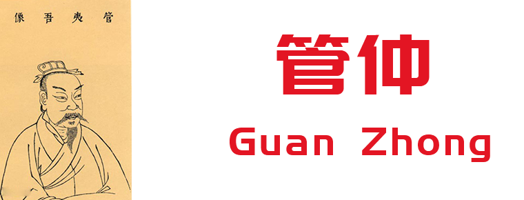 Guan Zhong
2019-09-07
0 Questions