2018-12-22
- By ChinaWiki.net
- Chinese Edition
- 2018-12-22
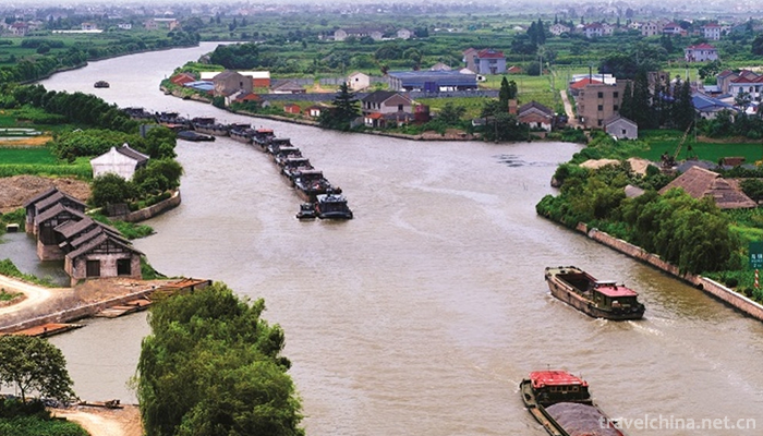
Beijing-Hangzhou Grand Canal is the longest and largest ancient canal in the world. It is also one of the oldest canals. It is called three great projects in ancient China together with the Great Wall and Kanerjing. It has been used up to now. It is a great project created by the working people in ancient China and one of the symbols of China's cultural status. The Grand Canal runs from Yuhang (now Hangzhou) in the south to Zhuojun (now Beijing) in the north. It passes through Zhejiang, Jiangsu, Shandong, Hebei and Tianjin and Beijing. It runs through the five major river systems of Haihe, Huanghe, Huaihe, Yangtze and Qiantang rivers with a total length of about 1797 kilometers. The Canal has played an important role in the economic and cultural development and exchanges between the north and the south of China, especially in the development of industrial and agricultural economy along the canal.
In the Spring and Autumn Period, Wu State was excavated to expel the Qi State. In the Sui Dynasty, it was greatly expanded to the capital city of Luoyang and Lianzhuo County. In the Yuan Dynasty, it abandoned Luoyang and took it to Beijing. It has been more than 2500 years since the excavation. In 2002, the Grand Canal was included in the Eastern Route of the South-to-North Water Transfer Project. On June 22, 2014, the 38th World Heritage Congress announced that the Grand Canal Project of China was successfully selected into the World Cultural Heritage List and became the 46th World Heritage Project of China.
In September 2014, the water departments of Tongzhou, Wuqing and Xianghe have signed strategic cooperation agreements. The Tongzhou-Xianghe-Wuqing section of the Beijing-Hangzhou Grand Canal is expected to resume navigation. It is planned to achieve initial navigation in 2017 and formal navigation in 2020.
History
The Grand Canal of Beijing and Hangzhou was built in the Spring and Autumn Period. During the Spring and Autumn Period and the Warring States Period, the canals were basically built to serve military operations to conquer other countries. For example, Wu Wang-fu sent men to dig Hangou for the direct purpose of transporting troops to the Northern Expedition of Qi. In 360 B.C., Wei Hui-wang digged the gap for the purpose of conquering other countries'military operations.
The Sui Dynasty made the decision to connect the North and South Canals after the unification of the world. Its motive went beyond serving the purpose of military operations, because the world had been unified at that time. The opening of the Sui Canal had economic motives. For a long time in ancient China, the economic center of gravity has been in the Yellow River Basin, and the economy of the North has been better than that of the south. But by the Wei, Jin, Southern and Northern Dynasties, profound changes had taken place in society. The chaos of more than 400 years has severely impacted the economy of the North. By contrast, the economy of the South has developed rapidly and has become the focus of the national economy. After the unification of the whole country, the Sui Dynasty attached great importance to this area, but Chang'an, the capital of Sui Dynasty, could not move southward with the development and change of the economic center of gravity. Therefore, the state needs to strengthen the management of the south, Chang'an needs to connect with the rich economic zone, and the South needs to supply food and materials to the north, whether it is the central court or the bureaucratic aristocracy or the northern border. At the same time, the long-term division has blocked the economic exchanges between the north and the south. With the improvement of productivity level, the development of economy in this period has urgently required the strengthening of economic ties between the north and the south.
The opening of the Sui Canal is not only an economic motive, but also a political one. The Wei, Jin, Southern and Southern Dynasties were the period of great development of the family of the nobles, and their strength was quite strong. After the unification of the Sui Dynasty, they still depended on their powerful forces and tried to compete with the central regime. This sharp contradiction has always existed in the southern part of the Yangtze River, which poses a serious threat to the Sui regime. It is imperative for the rulers of the Sui Dynasty to implement effective rule over the South and connect the North-South Canal. At the same time, the ethnic minority regime in the northern border area also suffered greatly from the Sui Dynasty. The Sui Dynasty sent a large number of troops to stationed on the border. These troops were not enough to rely solely on farming. They had to rely on the Yangtze-Huaihe River and the Central Plains for food supply. It's a long way to go. The key to solve the problem is to dig the canal.
The successive dynasties after Sui Dynasty and the late Qing Dynasty paid attention to the dredging and perfection of the canal, whether in the period of unification or in the period of division. Its motive was nothing more than economic, political and military aspects, making full use of canal transportation. On the basis of the canal, it has become one of the main means for the rulers of China to establish a huge and complex water transport system, and to transport the material resources from all parts of the country to the location of the capital. The reason why the canal is repaired and changed is that the canal is often blocked and the position of the capital of different regimes changes. By the Yuan Dynasty, the Grand Canal of Beijing and Hangzhou was connected, and the Grand Canal of Ming and Qing Dynasties became the main waterway between the north and the south.
The canal was excavated and renovated by the rulers, who gathered huge manpower and material resources to excavate the canal for the main purpose of water transport. The canal was created for the purpose of water transport, which was the life support and power supply system of the feudal dynasty and maintained the dynasty's life continuity. Because piracy and wind and waves are difficult to solve, Canal waterway transportation is the main choice in the history of waterway transportation. Digging the canal is a great feat that is worthy of the name and benefits of the present age. For the builders, its effect will appear soon, and it will have a decisive impact on the dynasty. So the wise rulers of all dynasties attached great importance to the construction of the canal.
build
The Beijing-Hangzhou Grand Canal was excavated in 486 B.C. and has a history of more than 2500 years. An important river course excavated by Qin Shihuang in Jiaxing also laid the foundation for the future development of the Jiangnan Canal. According to Yuejue Shu, Qin Shihuang's canal and canal culture derived from Jiaxing's "Zhiling Waterway" to Qiantang's "Yuedi, Tongzhejiang".
The Grand Canal was excavated in the Spring and Autumn Period, completed in the Sui Dynasty, flourished in the Tang and Song Dynasties, and dredged from the Yuan Dynasty to the Ming and Qing Dynasties. In the long years, it has undergone three major construction processes. The last construction is called the Beijing-Hangzhou Grand Canal.
- Late Spring and Autumn Period
Xuxi and Xupu are the earliest part of the Grand Canal, which is the embryonic period of the canal. It is said that they are named after Dr. Wu Zixu. The Monarch Fu Chao of Wu, who ruled the lower reaches of the Yangtze River at that time, had already conquered the State of Chu and the State of Yue before him only the State of Qi. In order to expedite the State of Qi to the north and compete for the hegemony of the Central Plains, he mobilized his civilian husband to excavate the canal from Yangzhou to the northeast through Sheyang Lake to Huai'an to the Huai'an River, which was named "Hanggou" because of its passage through Hangcheng. Li introduced the Yangtze River water into the Huaihe River and became the earliest section of the Grand Canal, which was built for water transportation. In the Warring States Period, great gullies (from now on, Yuanyang County of Henan Province diverted the Yellow River from the north to the South and into the nursery fields east of Zhengzhou City) and gullies were excavated successively, thus linking up the four rivers of the Yangtze River, Huaihe River and Jishui River.
King Wu later defeated the State of Qi in Ailing (now Tai'an, Shandong Province). In the first 482 years, in Huangchi (now southwest of Fengqiu, Henan Province), Wu was destroyed by the attack of Yue. Although Fuchai died, he left behind not only the prototype of Yangzhou, but also the canals are still in use today.
- Sui and Tang Dynasties
The Sui-Tang Grand Canal is divided into four sections: Yongji Canal, Tongji Canal, Hangou Canal and Jiangnan River.
After the reign of Emperor Yang of Sui Dynasty in the early seventh century, the capital of Luoyang was moved. In order to control the vast areas in the south of the Yangtze River and transport the rich materials from the Yangtze River Delta to Luoyang, Emperor Yangdi of the Sui Dynasty ordered in 603 to dig the Yongji Canal, about 1000 kilometers long, from Luoyang through Linqing in Shandong Province to Zhuojun in Hebei Province (now southwest of Beijing); and in the first year of Daye (605 A.D.), he ordered the opening of the Tongji Canal, about 1000 kilometers long, from Luoyang to Qingjiang in Jiangsu Province (now Huai'an City). Connecting the traffic between the Yellow River and the Huaihe River, and reforming Hangou and Jiangnan Canal; three years later, Yongji Canal and Beitong Zhuojun Canal were excavated, together with the wide canal excavated in 584 A.D., forming a multi-branch canal system. In 610 AD, the "Jiangnan Canal", about 400 kilometers long from Zhenjiang, Jiangsu Province, to Hangzhou, Zhejiang Province (then the foreign trade port), was excavated, and Hangou was transformed. In this way, the river between Luoyang and Hangzhou, which is more than 1700 kilometers long, can be directly connected to ships. Yangzhou is a famous city of the Li Canal. Emperor Yangdi of the Sui Dynasty excavated the canal in the city. Since then, Yangzhou has become a transportation hub between the north and the south. With the benefit of water transport, Yangzhou has become one of the most prosperous areas in China.
(1) Guangtong Canal, from Chang'an to Tongguan Dongtong to the Yellow River. Weishui is the main water source.
(2) Tongji Canal, which connects the water transportation of Huang and Huai rivers from Luoyang.
(3) Shanyangdu, which rises from the north to the south of Huai River (Huai'an District, Huai'an City, Jiangsu Province today), goes straight South and connects Jiangdu (now Yangzhou City) to the southwest of the Yangtze River.
(4) Yongji Canal, north of the Yellow River. From the Qinhe Estuary on the other side of Luoyang to the north, it leads directly to Zhuojun (now Beijing).
The Yuan, Ming and Qing Dynasties
At the end of the thirteenth century, after the capital of the Yuan Dynasty was established in Beijing, in order to connect the north with the South and stop bypassing Luoyang, it was necessary to dig a canal to transport grain from the south to the north. For this reason, three sections of rivers were excavated successively, and the Sui horizontal canal with Luoyang as its center was constructed into a longitudinal canal with the metropolis as its center and heading south directly to Hangzhou. It took the Yuan Dynasty 10 years to excavate the "Luozhou River" and "Huitong River" successively, connecting the natural rivers and Lakes between Tianjin and Qingjiang in Jiangsu, and the Hanggou and Jiangnan Canal in the south of Qingjiang River. Hangzhou. Between Beijing and Tianjin, the original canal was abandoned and the Tonghui River was newly built. In this way, the new Beijing-Hangzhou Grand Canal is more than 900 kilometers shorter than the Sui-Tang Grand Canal which bypasses Luoyang.
The key sections excavated in the Yuan Dynasty are the Sishui to Weihe section in Shandong Province and the Tongzhou section from Dadu to Tongzhou section. It was 75 kilometers long from Rencheng (Jining City) to Anshan (Dongping County) in the eighteenth year of the Yuan Dynasty (the year of Kublai Khan, the ancestor of the Yuan Dynasty) to Kaizhou River (1281 A.D.), and it was opened to the river in the twenty-sixth year of the Yuan Dynasty (1289 A.D.) to Nankai Canal in Anxi Province. From Shouzhang northwest to Linqing, the length is 125 kilometers; to the 29th year of the Yuan Dynasty (1292), Huihe River was opened, and the Changping waters of Beijing were diverted into the metropolis, and from Tongzhou to Baihe in the east, which is 25 kilometers long. By the thirtieth year of the Yuan Dynasty (1293), the Grand Canal was open to navigation. Cable boats could reach the metropolis directly from Hangzhou and became the predecessor of the present Beijing-Hangzhou Canal.
Beijing-Hangzhou Grand Canal is divided into seven sections according to its geographical location: Beijing to Tongzhou District is called Tonghui River, from Baifucun Shenshan Spring in Changping County through Wengshanpo (now Kunming Lake) to Jishuitan and Zhongnanhai, from the Civilization Gate (now Chongwenmen) to the east, from Yangzha Village in Chaoyang District to the southeast, and from Gaolizhuang (now Zhangjiawan Village) in Tongzhou to the Luhe River (the old road of the present North Canal), 82km long; The area to Tianjin is called the North Canal, which is 186 kilometers long; Tianjin to Linqing is called the South Canal, which is 400 kilometers long; Linqing to Taierzhuang is called the Lu Canal, which is about 500 kilometers long; Taierzhuang to Huaian is called the Central Canal, which is 186 kilometers long; Huaian to Guazhou is called the Li Canal, which is about 180 kilometers long; Zhenjiang to Hangzhou is called the Jiangnan Canal, which is about 330 kilometers long.
The foundation of the Yuan Canal was maintained in the Ming and Qing Dynasties, and the river sections in Shandong Province which had been silted up at the end of the Yuan Dynasty were re-dredged in the Ming Dynasty. From the middle of the Ming Dynasty to the early Qing Dynasty, canal projects such as Kaisukou Canal, Tongji New River and Zhonghe Canal, which separated the Yellow River from the Yellow River, were carried out between the Xia Town of Weishan Lake in Shandong Province (today's Weishan County) and Qing Jiangpu (now Huai'an). 。 The Beijing-Hangzhou Grand Canal, as the main traffic artery between the north and the south, has played a great role in history. The navigation of the canal has promoted the rapid development of coastal cities.
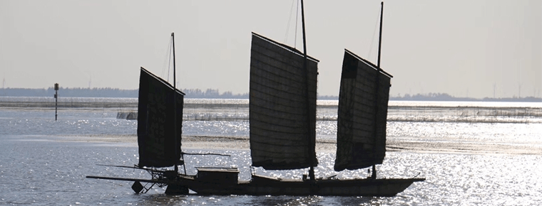
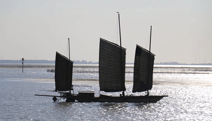
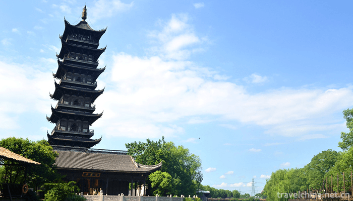
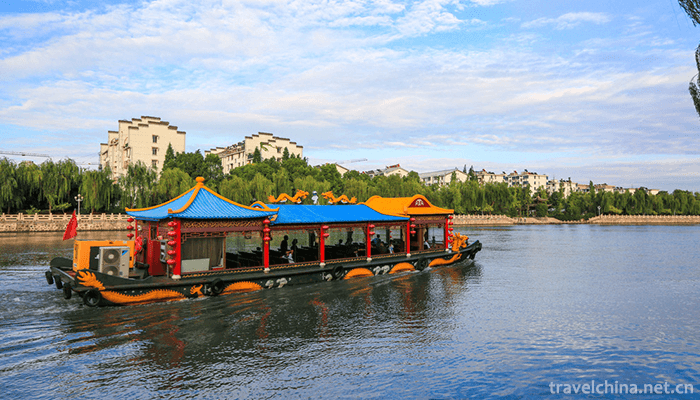
Tongzhou Ancient Poetry Cloud: A Tower Shadows Tongzhou. Lighthouse stands at the northern end of the Grand Canal. It is a landmark building in Tongzhou, Jingmen. Tianjin North Canal and South Canal joined forces in Tianjin, where they were sent to the Bohai Sea by the Haihe River. According to records, in the developed period of waterway transportation, 20,000 watercraft carrying grain were carried on the North Canal from Tianjin to Tongzhou every year, 120,000 officers and soldiers, together with 30,000 merchant ships. The opening of the waterway made the small Zhigu village develop into the well-known Tianjin Wei. The junction of Zhenjiang, Yangzhou Yangtze River and Beijing-Hangzhou Grand Canal. Liaocheng Lake and rivers account for one third of the urban area, which is called "Venice in North China", and are very rare in northern cities, among which the Beijing-Hangzhou Grand Canal is the credit. Suzhou "Suhu is ripe and the world is full". The opening of the canal has made Suzhou rich in water and food. There are passenger routes to and from the Suzhou-Hangzhou section of the Grand Canal. At the entrance of the Huai'an Grand Canal, Wu Chengen, the author of Journey to the West, lives at the pier of the ancient town on the East Bank of the canal.
Modern and Contemporary
In 1842, the British army won the Opium War by seizing Zhenjiang at the junction of the Beijing-Hangzhou Grand Canal and the Yangtze River, blocking the waterway transportation, so that Emperor Daoguang made a quick decision to seek peace, and soon signed the Sino-British Treaty of Nanjing.
After 1853, the Taiping Heavenly Kingdom occupied Nanjing and Anhui along the Yangtze River for more than ten years, and the canal transportation was interrupted. The war was extremely tragic, during which major cities along the route were severely damaged, and some or all of them were burned down.
After the Yellow River was diverted in 1855, the Shandong section of the canal was gradually silted up. From then on, waterway transportation was mainly changed to sea route.
In 1872, the Ship Merchants Bureau was established in Shanghai and formally transported grain by ship.
In 1904, the Governor of Water Transport was also abolished.
In 1911, the Jinpu Railway was opened to traffic. Since then, the status of Beijing-Hangzhou Grand Canal and the cities along it has declined dramatically.
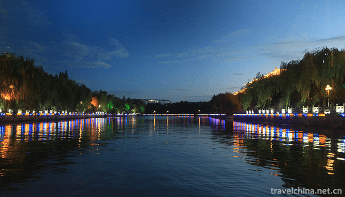
After liberation, the canal was renovated on a large scale to give full play to its various roles of shipping, irrigation, flood control and drainage. Some sections of the canal have been widened and deepened, bended and straightened, many modern wharfs and locks have been built, and shipping conditions have been improved. Seasonal mileage has reached more than 1,100 kilometers. In the 660 km waterway south of Pixian County, Jiangsu Province, 500 tons of fleet can be unimpeded.
The communication project between Beijing-Hangzhou Canal and Qiantang River, completed at the end of 1988, has connected rivers, rivers and seas.
In 2002, the Beijing-Hangzhou Grand Canal, originally only responsible for navigation, was included in one of the three routes of the South-to-North Water Transfer Project, and became an important link and channel of the East Route of China's South-to-North Water Transfer Project, through which water from the lower reaches of the Yangtze River could be transported to water-deficient areas such as Shandong and Hebei in the north.
Application
With its unique communication function, the Beijing-Hangzhou Grand Canal connects the political center and economic center of the whole country, and links the production areas of different river basins. On the basis of it, the feudal rulers established a thousand-year-old water transport system for transporting materials from different places to the capital, which maintained the dynasty's life.
In the course of waterway transportation, the water transportation around the canal, the related aspects of grain allocation, collection, delivery, escort, unloading, storage and so on, are constantly updated and developed according to local conditions in the actual process, which makes the waterway transportation system develop and change several times. Every change is the development of summing up the experience and lessons in practice and seeking truth from facts to solve problems. For example, the Tang Dynasty Prime Minister Pei Yaoqing changed the "direct transport law" to "sectional transport law", that is, water transport means canal transport, shallow water means warehouse, granary located along the canal. In this way, the water boat will not stop, and the water grain will not be lost, thus greatly improving the water transport capacity. In the late Tang Dynasty, on the basis of the "Sectional Transport Law", the "Transport Law" was created, which changed the civil transport to the official transport, the bulk transport to the standard sack filling, the ship formation and so on, and the integrated and systematic transport. Establish a reward system for water transport, and take salt profit as the Commission to solve the problem of water transport funds. These innovations effectively promote the development of water transport. In Song, Yuan, Ming and Qing dynasties, according to the actual conditions of the canal, innovative methods were constantly introduced in order to better play the role of the canal.
The rulers'use of the canal also changed pragmatically in the Ming and Qing Dynasties. In the Ming and Qing Dynasties, with the development of commodity economy and the increasing market behavior of society, the demand for material exchange between North and South increased greatly. On the one hand, water transport stimulated the development of commercial activities along the canal, on the other hand, water transport itself became more and more commercialized. First of all, private goods are transported by water, from less to more. The court could not help but take the initiative to explicitly allow the boat to go north with certain cargo, and the boat to carry passengers when returning south. This change in water transport policy is a pragmatic approach of the government. On the one hand, it is an existing fact that the smuggling of watercraft can not be curbed. On the other hand, it can subsidize the livelihood of watercraft workers. At the same time, the officials and gentry also have this demand. With the increasing amount of cargo carried by watercraft, the trade of watercraft is becoming more and more active, and many commercial towns have sprung up along the canal. Such as Tongzhou, Zhigu (Tianjin), Cangzhou, Dezhou, Linqing, Xuzhou, Huaian and so on. Silk, tea, sugar, bamboo, wood, lacquer, ceramics and other goods from the south are constantly being transported to the north. Pines, leather goods, coal and sundry goods from the north are also constantly descending from the south of the canal. Although the Grand Canal was opened by water transport, when there was a demand for commercial transport, the rulers also kept pace with the times and made it a river of commercial transport and people's transport.

Ask a Question
Your email address will not be published.
Latest Post
-
 Jiulushan Waterfalls Scenic Spot
 -
 Jiajiang Tianfu Tourist Tea Garden
2019-01-21
-
 Quanzhou breast clapping dance
2019-06-11
0 Questions