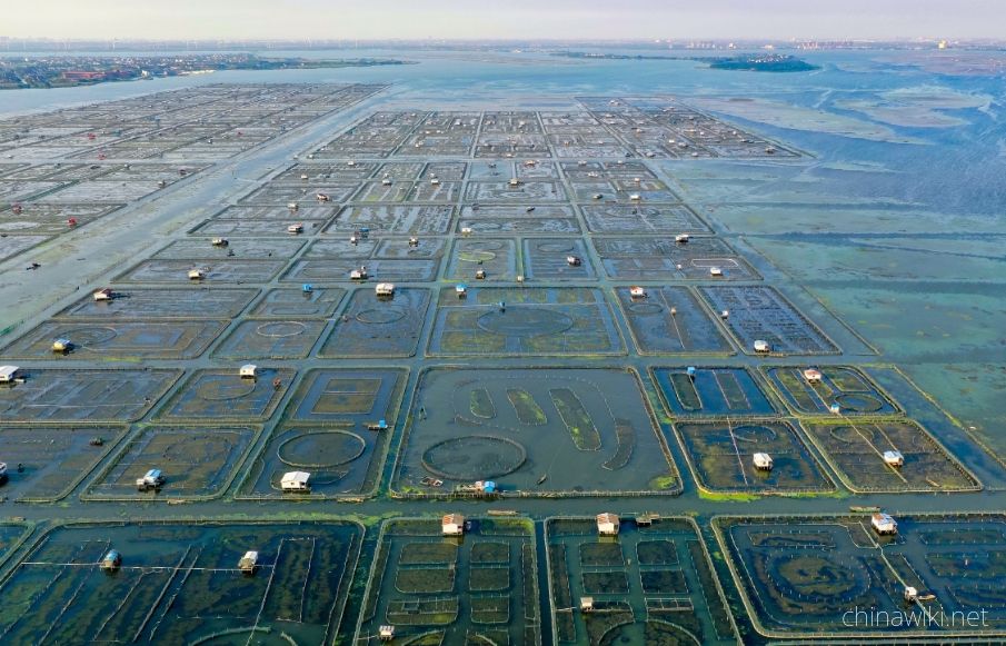
Water Resources Situation in Jiangsu Province
jiangsu has abundant water resources, with annual runoff depth ranging from 150-400 millimeters during rainfall. Deep Quaternary loose deposits are widely distributed in the plain areas of jiangsu Province, with abundant groundwater sources. The total groundwater resources in the province are 14.24 billion cubic meters, including 13.44 billion cubic meters in plain areas, 1.31 billion cubic meters in hilly areas, and 510 million cubic meters in double counting. jiangsu has numerous rivers and lakes with complex water systems. The local water resources amount to 32.1 billion cubic meters, and the average annual transit water volume is 949.2 billion cubic meters, of which the Yangtze River runoff accounts for more than 95%
-
1.Jiangsu Province in the Pre Qin Period
Archaeological discoveries indicate that humans existed on the land of Jiangsu as early as the Paleolithic era, and cultural sites from the New Era have also been discovered in various parts of Jiangsu. During the Xia, Shang, and Zhou dynasties, the Jiang
Time 2024-12-28 -
2.Jiangsu Province during the Qin and Han Dynasties to the Southern and Northern Dynasties
After Emperor Qin Shi Huang unified China, the system of prefectures and counties was implemented. During the Qin Dynasty, the northern part of Jiangsu Province was divided into Sishui County, Donghai County, and Langye County, while the southern part of
Time 2024-12-28 -
3.Jiangsu Province during the Sui, Tang, Song, and Yuan Dynasties
In 581 AD, Emperor Wen of Sui unified China, with the northern part of Jiangsu roughly belonging to Xuzhou and the area south of the Huai River roughly belonging to Yangzhou. In 618 AD, the Li Tang Dynasty was established. During the Tang Dynasty, Jiangsu
Time 2024-12-28 -
4.Jiangsu Province during the Ming and Qing Dynasties
In 1368, Zhu Yuanzhang established a political power in Yingtian (now Nanjing) as the capital city. Later, Yingtian changed its name to Nanjing and then to Jingshi, also known as Zhili. After Ming Chengzu established the name Yongle, he moved the capital
Time 2024-12-28 -
5.Jiangsu Province during the Republic of China period
In 1912, the Republic of China established a provisional government in Nanjing, with Sun Yat sen serving as the interim president. In April of the same year, Yuan Shikai usurped the fruits of the revolution, and Jiangsu fell into the sphere of influence o
Time 2024-12-28 -
6.Location and territory of Jiangsu Province
Jiangsu Province is located in the middle of the eastern coastal area of Chinese Mainland, at the lower reaches of the Yangtze River and Huaihe River, bordering the Yellow Sea to the east, Shandong to the north, Anhui to the west, and Shanghai and Zhejian
Time 2024-12-28 -
7.Climate situation in Jiangsu Province
Jiangsu belongs to a transitional climate from temperate to subtropical, with the Huai River and the main irrigation canal in northern Jiangsu as the boundary. To the north, it belongs to a warm temperate humid and semi humid monsoon climate, while to the
Time 2024-12-28 -
8.Geological conditions of Jiangsu Province
Jiangsu Province is located in the North China plate, the eastern section of the Qinling Dabie orogenic belt, and the Yangtze plate, which cross the Chinese Mainland. The regional geological background and tectono magmatic activity are obviously different
Time 2024-12-28 -
9.Hydrological and Water Conservancy Situation in Jiangsu Province
Jiangsu Province spans across rivers and coasts, with numerous lakes and a dense water network, adjacent to land and sea. It is the only province in China with large rivers, lakes, and seas. The Yangtze River spans 433 kilometers from east to west, and th
Time 2024-12-28 -
10.Forest Resources in Jiangsu Province
In 2017, the forest area in Jiangsu Province was 1.56 million hectares, with a forest coverage rate of 22.9% and a total standing timber volume of 96.09 million cubic meters. There are 6 national forest cities (Wuxi, Yangzhou, Xuzhou, Nanjing, Zhenjiang,
Time 2024-12-29 -
11.Wetland Resources in Jiangsu Province
In 2017, Jiangsu Province had 2 internationally important wetlands, 5 nationally important wetlands, and 64 wetland parks at or above the provincial level, including 26 national wetland parks and pilot projects, and 38 provincial-level wetland parks
Time 2024-12-29 -
12.The situation of marine resources in Jiangsu Province
The Jiangsu sea area is located in the central northern part of China's sea area, at the center of the western Pacific coast, facing South Korea and Japan across the sea. It has a superior geographical location and an important strategic position, with a
Time 2024-12-29