Yangtze River Source of Tuotuo River
Yangtze River Source of Tuotuo River
Tuotuo River: Located in Tanggula Mountain Town, Southern Region of Golmud City, Qinghai Province, it is the West source of the Yangtze River, south of the Hoh Xili Mountains. When it originated from the Jianggendi Glacier in Eastern Snow Mountains of Gradan, it was a stream of melting water from glaciers and ice buckets. At that time, the water surface was only 3 meters wide and only 20 centimeters deep. Then it flowed northward over a distance of 9 kilometers. Under the Bashan Mountains, the melting water from the glacier of the Gaqiadi Glacier Mountains was collected. After a valley about 15 kilometers long, it continued northward and was divided into two 4 meters wide. With the 6-meter river, there are many cobweb-like currents in the valleys on both sides of the river, which is the upper source of the Tuotuo River. At the exit of the valley, the valley suddenly cut down, forming a steep valley about 5 kilometers long, as high as more than 20 meters. After the confluence of many rivers, the Tuotuo River, the source of the Yangtze River, with its open channel and interlaced current, has been formed.
Administratively, it is under the jurisdiction of Tanggula Mountain Town, Golmud City (attached area).
Related: along the Tuotuo River, the source stone tablet of the Yangtze River, the Tuotuo River Bridge and the Tuotuo River Railway Station.
Views on historical changes: in ancient times, the river after Garqu merged into Buqu was called Tongtian River (upper section), and that place was called Tongtian River (along Tuotuo River in the north), and Buqu was regarded as the main source; after the investigation in 1976, Tuotuo River was considered to be a long and large water volume, which stipulated that Tuotuo River was the main source and that the river below was called Tongtian River; later, it was found that Dangqu River was longer and had larger water volume. The Tongtianhe Bridge on Qinghai-Tibet Highway refers to Dangqu Bridge; the concept of river trees regards Buqu as the mainstay; contemporary Qinghai-Tibet Railway takes into account the historical term, and sets up Tongtianhe Station near the Buqu intersection along Tongtianhe.
Travel Tips
There are twenty or thirty roadside restaurants in the nearby town along the Tuotuo River (the residence of Tanggula Mountain Town), but the price of meals is more expensive. There are also 67 small hotels with general accommodation, and each bed charges 20 or 30 yuan per night. After 2008, it was merged into the State Grid and drinking water was also purified from the railway station.
The source of the Yangtze River (one of the three sources): that is, the source of the Yangtze River, that is, several sources of the Tongtian River, lies between the Kunlun Mountains and the Tanggula Mountains in the hinterland of the Qinghai-Tibet Plateau.
Historically, there are four sources: 1) Zhengyuan Benzhi (South Branch) is the first Tongtian River, which is the upper part of the Tongtian River in ancient times, i.e. Buqu, which is the main trend of the Qinghai-Tibet Railway in Tanggula Mountain Town area; 2) Zhengyuan Nanzhi Dangqu comes from the marshes at the eastern foot of the Tanggula Mountains, accepting Dangqu to form the second Tongtian River; 3) Zhengyuan Xizhutuo River began in Tanggu. The main peak of the La Mountains, the Great Ice Peak of Gradan East, forms the third Tongtian River when it accepts the Tuotuo River. 4) The Chumar River in the North originates from the southern foot of the Black Ridge Mountain in the Hoksili Mountains, which is the southern branch of the Kunlun Mountains, and the fourth Tongtian River is formed when it is accepted. Lemaqu (Xiushui River) between Zhengyuan and Beiyuan is the seasonal river.
In 1976, the investigation considered that the Tuotuo River was the main source. It was stipulated that the Tuotuo River would be called Tongtian River only when it joined the big river below, and Buqu in the upper reaches of Tongtian River in history was reduced to the largest tributary of Dangqu.
Later, it was found that Dangqu was the largest: it was longer than Tuotuo River and had a larger amount of water.
River Tree Concept: Buqu is the backbone of Tongtian River, with two branches left and right.
Contemporary Consideration: The contemporary Qinghai-Tibet Railway has Tongtianhe Station parallel to Tuotuohe Station (along the Tuotuohe River) in the place historically known as Tongtianhe Railway, taking into account the customary appellation in history.
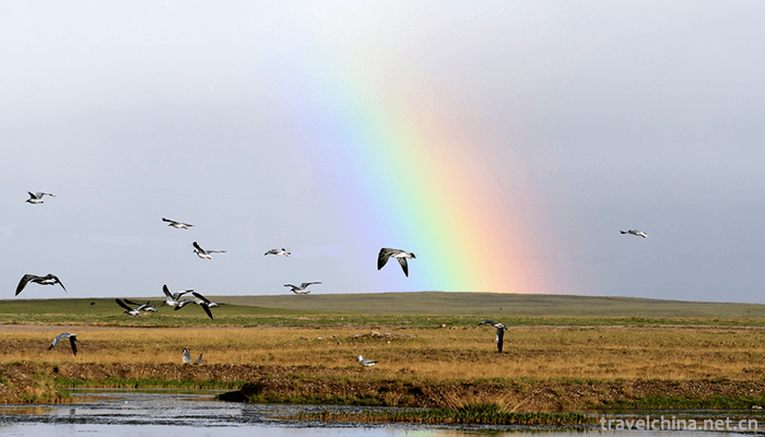
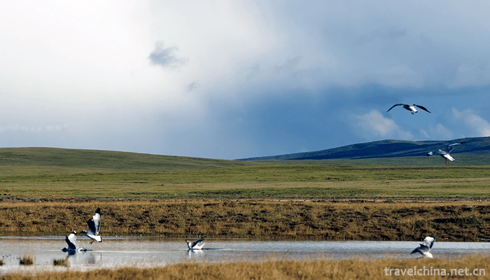
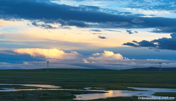
The Yangtze River source landscape is very magnificent, with snow mountain iceberg, boundless grassland, blue sky and white clouds reflected in the river water, constituting a relaxing and pleasant scenery.
The Yangtze River Source Reserve and the Kekexili Nature Reserve are interrelated, and its western part belongs to the Kekexili Nature Reserve and Tanggula Mountain Town.
Water volume comparison: Dangqu, the main source of the Yangtze River, has the largest amount of water and the longest length.
Introduction to Tuotuo River
Tuotuo River is also called Tuotuo River. Also known as the Ulan Mulun River, Mongolian means "Red River". Xiyuan of the Yangtze River in China. It originated in the glaciers on the southern side of East Snow Mountain in Geladan, the main peak of Tanggula Mountains. It is 375 kilometers (233 miles) long and forms the source water system of the Yangtze River together with Dangqu and Chumar rivers.
Tuotuo River is the Western source of the Yangtze River. As early as Shangshu, people were discussing the origin of the Yangtze River. Xu Xiake, a famous Traveler in the Ming Dynasty, believed that the Jinsha River was the origin of the Yangtze River and wrote the book Jiangyuan Kao. By the Qing Dynasty, people had realized the Tongtian River, but still could not determine the source of the Yangtze River. In 1956 and 1977, China visited the source areas of the Yangtze River twice. In 1977, it was found that the Tuotuo River, which originated in Geladandon, was the source of the Wanli Yangtze River.
When the Tuotuo River originated from Jianggendi Glacier in Geladandong, it was a stream of melted water from glaciers and ice buckets. At that time, the water surface was only 3 meters wide and only 20 centimeters deep. Then it flowed northward over a distance of 9 kilometers. Under the Badong Mountains, it collected melted water from the glaciers of the Gaqiadi Glacier Mountains. After a valley about 15 kilometers long, it continued northward and was divided into two 4 meters wide and four meters deep. There are many cobweb-like currents in the valleys on both sides of the 6-meter river, which is the upper source of the Tuotuo River. At the exit of the valley, the valley suddenly cut down, forming a steep valley about 5 kilometers long, up to more than 20 meters.
After flowing out of the Badong Mountains, the river first passes through a vast floodplain, then through a canyon, and then flows to the Hulu Lake, where it turns eastward. After more than 130 kilometers of flow, the river became wider. When it reached the Tuotuo River along the Qinghai-Tibet Highway, it was already a big river with a depth of 3 meters and a width of 20-60 meters.
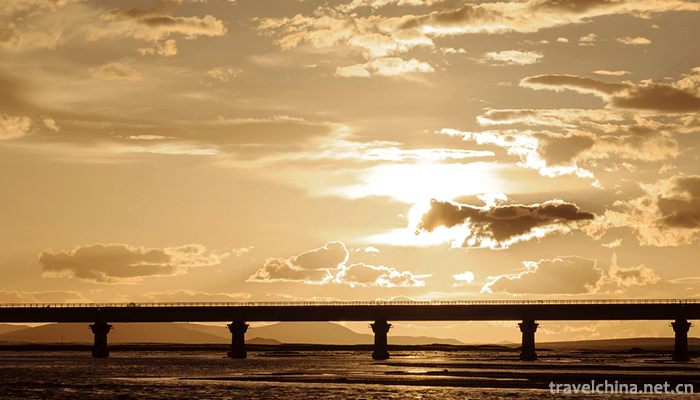
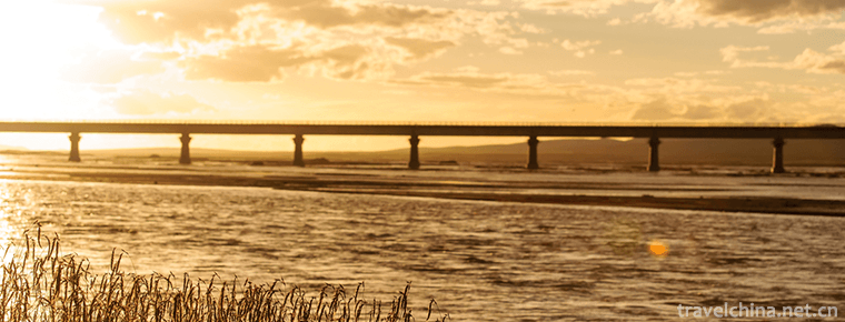
The famous Wanli Yangtze River First Bridge is built on the beach along the Tuotuo River. It is 324 meters long and 11 meters wide reinforced concrete bridge.
The Tuotuo River continues eastward from here, and joins Dangqu, Buqu and Dorqu at the time of Baoji Balong. It passes 375 kilometers and forms a large river more than 30 meters wide. From here its name is Tongtian River.
Pictures From:
http://bbs.fengniao.com/forum/10545389.html


-
1.Baishuiyang Yuanyangxi Tourist Area
Baishuiyang Mandarin Creek is located in Pingnan County, Ningde City, Fujian Province. It is 170 kilometers away from Fuzhou and 101 kilometers away from Ningde
Time 2018-12-08 -
2.Three Lanes and Seven Alleys
Three Lanes and Seven Alleys(Sanfang Qixiang) is a national 5A tourist attraction, which is the only remaining part of the old city of Fuzhou
Time 2018-12-08 -
3.Eight Immortals Crossing the Sea Scenic Area
Eight Immortals Crossing the Sea Scenic Area, also known as Eight Immortals Crossing the Sea and Eight Immortals Crossing the Haikou, is situated on the shore of the North Yellow Sea in Penglai City
Time 2018-12-23 -
4.Red Flag Canal Scenic Area
Red Flag Canal Scenic Area is a national AAAAA class scenic area, covering an area of five square kilometers. Red Flag Canal Scenic Area is composed of Red Flag
Time 2019-01-16 -
5.martial art of emei
Emei Wushu is one of the traditional Chinese Wushu schools, and its birthplace is Emei, a famous mountain in China. Including the worldwide spread of "Five Flowers"
Time 2019-04-28 -
6.Two strands
Erguxian is an ancient traditional opera, which was formed in Song Dynasty and has a history of more than 500 years. The two-strand string is evolved from folk minor,
Time 2019-04-28 -
7.Legend of Camel Spring
Camel Spring is a provincial key cultural relic protection unit and a patriotic education base. Located in Jiezi Township Unity Village, with convenient transportation and direct access to tertiary oi
Time 2019-05-15 -
8.Beijing University Of Technology
Founded in 1960, Beijing University of Technology is a multi-disciplinary municipal key university with a combination of engineering, science, economics, management, literature, law, art and education
Time 2019-09-06 -
9.West Anhui University
West Anhui University (West Anhui University) was the 3 menstrual period of 2000. Ministry of Education Approved provincial comprehensive Undergraduate Colleges From the original West Anhui United Uni
Time 2019-11-20 -
10.Zhaohua ancient city
Zhaohua ancient city is located in Zhaohua Town, Zhaohua District, Guangyuan City, Sichuan Province. After that, Zhaochang county was renamed as Yichang county. Located at the confluence of Bailong River, Jialing River and Qingjiang River, the Jialing River flows here with Wancheng water system and natural Taiji. It has the reputation of "the world's first landscape Taiji" natural wonder.
Time 2020-11-08 -
11.Meishan special food
Meishan traditional delicacies and specialties include: sugar and oil fruit, spicy sausage, Sichuan fried spring rolls, Dongpo bean curd elbow, stone bean curd, Dongpo cuttlefish, Dongpo sausage, sweet potato sugar, Meishan Qiao Jiao beef, yameizi so
Time 2020-12-18 -
12.Guangan Airlines
There is no airport in Guang'an, but there are many airports around it. At the same time, Guang'an terminal building of Chongqing Jiangbei International Airport has been built in the urban area. Guang'an is 110 kilometers away from Chongqing Jian
Time 2020-12-19