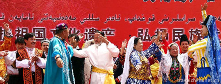
Xinjiang Uygur Mukam Art
Xinjiang Uygur Mukam Art is a large-scale integrated classical music art form which integrates singing, dancing and music. It is the general name of "Twelve Mukam" and "Daolang Mukam&qu
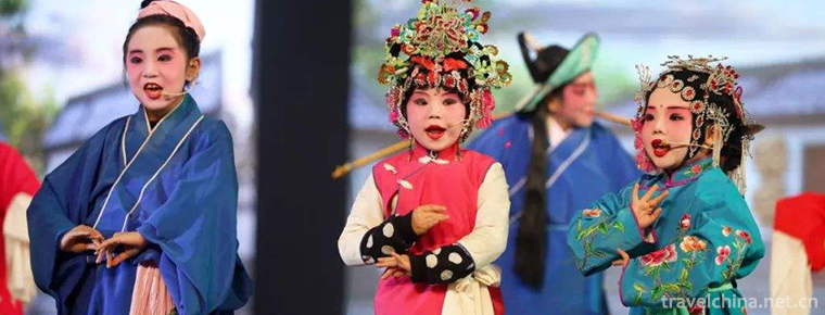
Xinjiang Opera
Xinjiang Opera, commonly known as "Xinjiang Xiaoqu", is a kind of local opera with unique style, which has been gradually formed and perfected after Shaanxi Opera, Qinghai Pingxian Opera, La
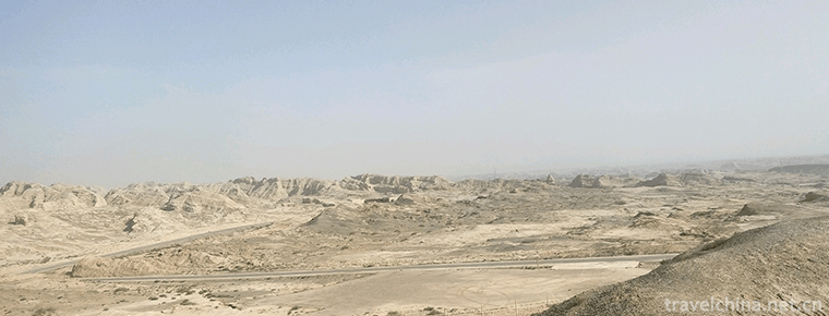
Yangda Kuduktur Beacon Platform Site
Beacon also known as beacon platform, beacon platform, Yandun, pyrotechnic platform. If there were enemies, smoke in the daytime and fire in the evening were the quickest and most effective ways to tr
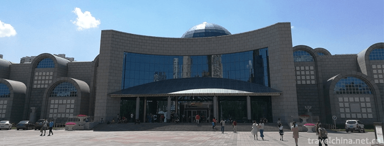
Museum of Xinjiang Uygur Autonomous Region
The Museum of Xinjiang Uygur Autonomous Region, located at No. 132 Northwest Road, Urumqi City, is a provincial comprehensive geographic museum.
Xinjiang Tianshan
Tianshan Mountain in Xinjiang, the eastern part of the Tianshan Mountains, is also the main part of the Tianshan Mountains and the world natural heritage. Tianshan Mountain is one of the seven major m
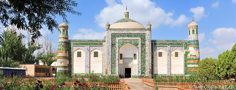
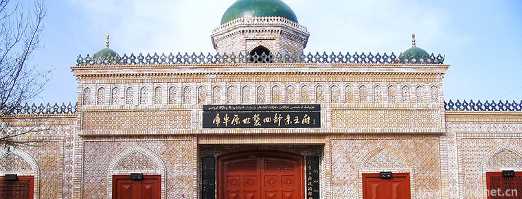
Abakh Hoja Tomb
Xiangfei Tomb is located in Haohan Village, 5 km east suburb of Kashgar City. It is a key cultural relic protection unit in the autonomous region. This is a typical Islamic complex of ancient building
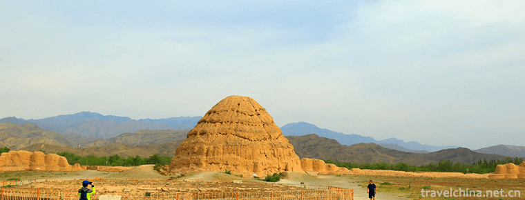
Western Xia imperial tombs
The Mausoleum of the Xixia Dynasty, also known as the mausoleum of the Xixia Emperor and the mausoleum of the Xixia Emperor, is the mausoleum of the successive emperors and the Royal Mausoleum of the
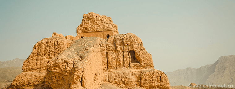
Subashi Buddhist Temple Site
Subashi Buddhist Temple Site , also known as Zhaohuili Temple, is located in the south foot of the Queletag Mountains in the northeast of Kuqa County, Xinjiang. It is a national key
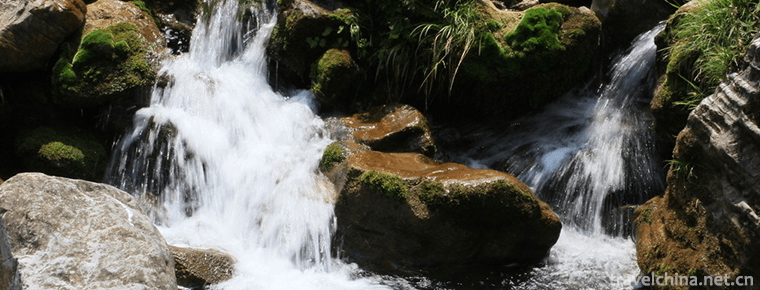
Shuimogou Scenic Area
Shuimogou Scenic Area, also known as Shuimogou Park, is named after Shuimogou in the scenic area. It is located in the eastern suburb of Urumqi, Xinjiang. Around 2000
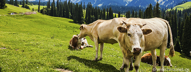
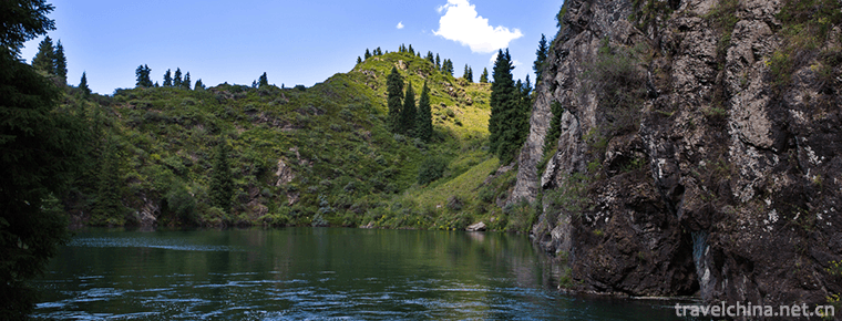
Narati Scenic Spot
Narati Tourist Scenic Area, located in Xinyuan County, Xinjiang, is located in the hinterland of Tianshan Mountains, the eastern end of the Ili Valley, with a total planning area of 960 square kilomet
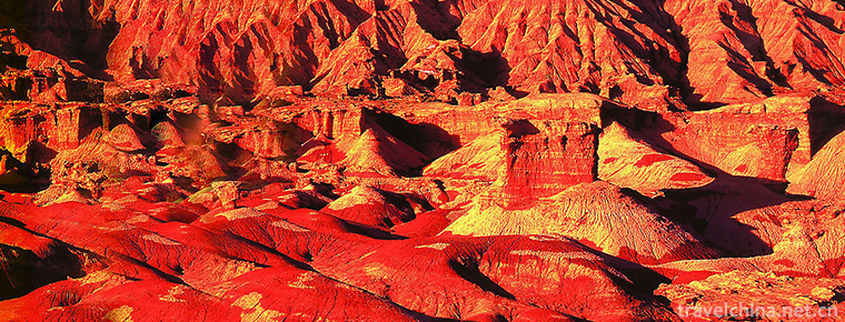
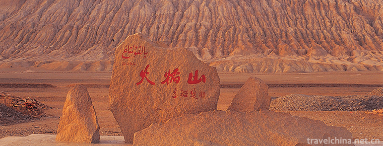
Devil City
The Devil City is also known as the Wind City of Urho. Wuerhe Mining Area in the lower reaches of Jiamu River, located in the northwest margin of Junggar Basin
Rob Village
Located 35 kilometers southwest of Yuli County, Luobu Village is 85 kilometers south of Korla City. The village covers 72 square kilometers and has more than 20 families
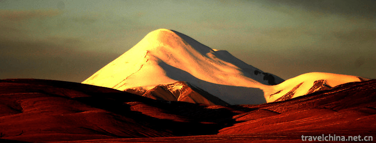
Kunlun Mountains
Kunlun Mountain, formerly known as Kunlunqiu, also known as Kunlunxu, is the god mountain in ancient Chinese legend, the ancestor of Wanshan Mountain, the birthplace of Chinese civilization, and the k
Kuqa Wangfu Scenic Area
Located in Kuqa County, Xinjiang, the "Kuqa Wangfu" was built by Emperor Qianlong of Qing Dynasty in 1759 by dispatching Han craftsmen from the mainland in order to commend the local Uygur l
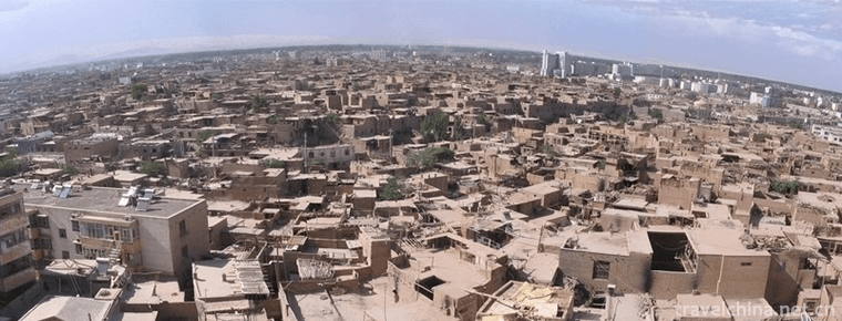
Old city of Kashi
The old urban area of Kashgar City in Xinjiang is like a living cartoon of Xinjiang Uygur folk customs. The old urban area of Kashgar is located in the centre of Kashgar
Jinhu Yang National Forest Park
Zepujin Lake Yang National Forest Park is located 40 kilometers southwest of Zepu County in the Gobi Depth, located in the upper edge of the Yerqiang River alluvial fan
Jiangbulak Scenic Area
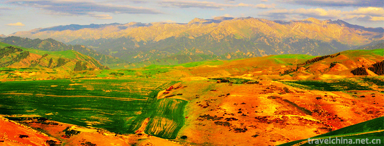
Jiangbulak Scenic Area is located in the low mountain belt 58 kilometers southeast of Qitai County, Xinjiang, China. It includes wide gully scenic area and Yangwatan beach
Flaming Mountains
Flame Mountain in Xinjiang is the most famous scenic spot in Turpan. Located in the northern margin of Turpan Basin, the northern route of the ancient Silk Road is mainly composed of red sand